The Book
20 Jan 2026
Publishing a Book in the 2020s
How the digital revolution reshaped academic journals and book publishing alike.
Read moreFrom Gondwana and the Dutch mariners to the founding of a convict-free colony.
15 Jan 2026
Related writing
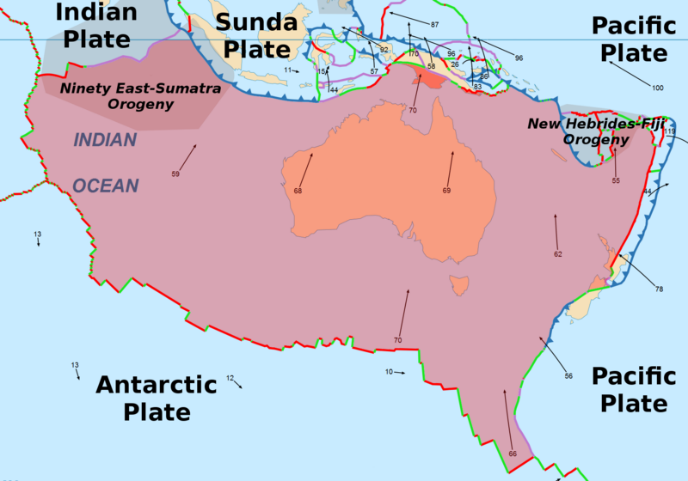
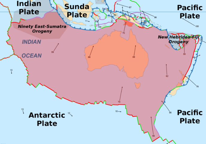
One hundred million years ago the tectonic plate bearing the island continent of Australia severed its connection to India, and in doing so completed its separation from the ancient landmass of Gondwana. Today the landmass of Australia, the smallest continent, lies distant from the fault lines which contribute to the Pacific “ring of fire” that skirts New Zealand and New Guinea. With no volcanoes or major earthquake fault lines it is also the flattest continent. These geographic idiosyncrasies have had a huge influence on the challenging climate and fertility of the barren sandy soils of Australia. On the bright side however, massive concentrations of iron, uranium, copper, nickel as well as gold and silver and diamonds as well as rich carboniferous lodes of coal and oil and natural gas have been undisturbed, ready to provide the energy and the iron and the steel and the rare and precious metals and jewels needed by the industrializing world, particularly in nearby Asia.
At least fifty thousand years ago the ancestors of Australian aborigines migrated across the shallow seas and the Indonesian island stepping stones to reach Australia where they evolved to become one of the most genetically isolated peoples of the world. Although they came from southeast Asia, they bear little resemblance to the genetic predecessors of today’s southeast Asian populations. In fact many archeologists believe they represent one of the most direct lineages from the initial migration of Homo sapiens out of Africa seventy-five thousand years ago.
Having a unique genetic heritage is also characteristic of the diverse flora and fauna that fascinated naturalists like Joseph Banks who accompanied Captain James Cook on his voyage of discovery of the east coast of Australia, then “New Holland” in 1769.
The name “New Holland” can be traced to the golden age of Dutch maritime supremacy in the 1600’s. By the late 1500’s they had already established their presence in the East Indies, today’s Indonesia and were shipping spices back to “old” Holland at great profit. Although their first sighting of the Australian continent in 1606 was Cape Yorke at the north east corner close to Java, by far the preponderance of Dutch contact with Australia was on the west coast and was unintentional.
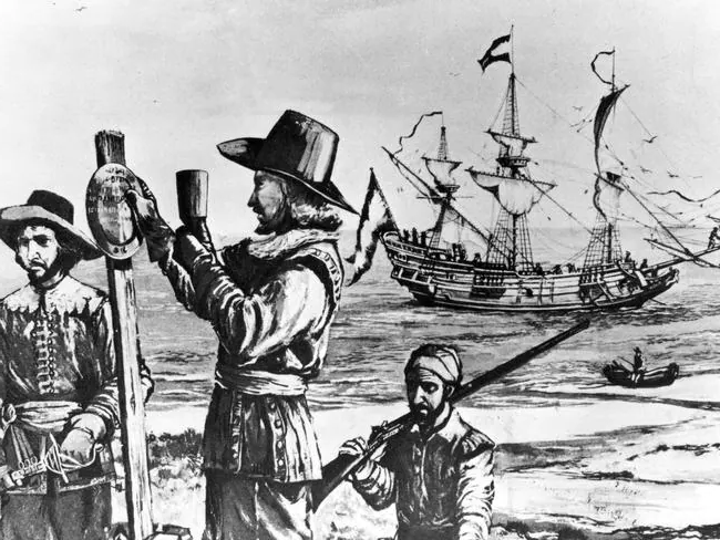
In 1616 Dirk Hartog on his way to Java encountered a barren island, now “Dirk Hartog Island” off the middle of the west coast of what today is the state of Western Australia. Like many Dutch sailors to follow, Hartog had harnessed the “roaring forties”, the constant powerful westerly winds that blow from the Cape of Good Hope at the tip of the African continent towards Australia between latitudes 40 and 50. Early navigators could pinpoint their latitude accurately using the stars and sun, but determining longitude required estimation of speed and measurement of time, both of which were lacking. A wrong reckoning of longitude resulted in many early ships of the Dutch East India Company running aground on the west coast of Australia when they failed to head north to Indonesia when they should have. The hardships endured by early Dutch travelers have been captured in the graphic description of the “Wreck of the Batavia” that occurred in 1629.
By the early 1700’s England and Scotland had united as Great Britain and emerged from the tumultuous century of the Stuarts and Oliver Cromwell. George the First and the German House of Hanover took over the British crown. Holland and Spain soon ceded global hegemony to Great Britain and the British Navy ruled the waves. The scourge of scurvy had been cured with a diet including citrus fruits and British sailors became “limeys”. Although Captain James Cook was supposedly commissioned by the navy in 1768 to lead an around-the-world voyage culminating in observation of the transit of Venus across the sun, a rare astronomical event visible from Tahiti, he was also acting on behalf of the Crown to expand the territories of the British Empire: hence his interest in mapping the east coast of New Holland. Cook named this new east coast colonial acquisition “New South Wales”. It was more than 30 years later before another British Navy captain, Matthew Flinders, circumnavigated the entire continent and named the new country and continent “Australia”.
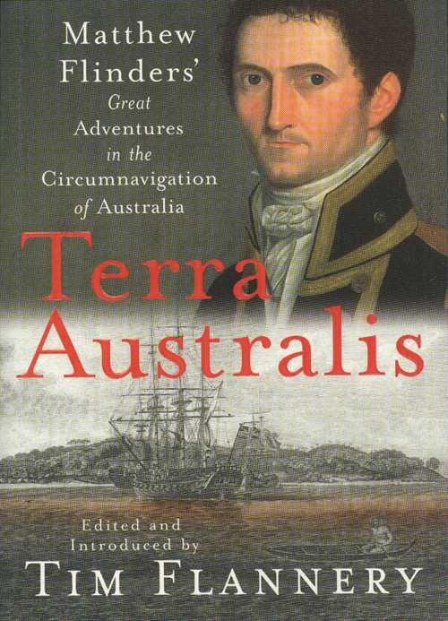
Matthew Flinders was the first to map the southern coast of the continent. He traced the irregular coastline of what would later become the state of South Australia including the major gulfs of St Vincent and Spencer’s Gulf as well as an adjacent large island with many kangaroo-type creatures (actually “wallabies”) that he named Kangaroo Island. What he could not have known from his coastal voyages was that although the land adjacent to the coast was reasonable fertile as a consequence of a low range of hills later to be named ironically the Mount Lofty Ranges, north of the gulfs was a fearsome, flat, featureless desert that extended thousands of miles to the north and west. The same was true of the west coast of Australia. The land adjacent to Cape Leeuwin, the southwest tip of the state of Western Australia and the country of Australia caught the edge of the moisture captured by the roaring 40’s as they raced across the Indian Ocean from the Cape of Good Hope, but further north were endless deserts. Two thousand miles east of Cape Leeuwin, the Mount Lofty Ranges squeezed a small amount of additional moisture from the westerly winds even though they had travelled over desert from the western shores of the country by the time they got to what is now the Adelaide Plains between the Mount Lofty Ranges and the Gulf of St Vincent. The Adelaide Plains……the site of the state capital, Adelaide…….of the state of South Australia, my birthplace and home for the first 23 years of my life.
Just seven years after Captain Cook had mapped the east coast of New Holland, Britain had a new problem on its hands. The onset of the American War of Independence in 1775 meant that the transportation of criminals and convicts to the American colonies came to an abrupt end. Very soon the London prisons were overflowing. Urbanization was gathering steam as the industrial revolution was underway following the invention of machines, initially for the textile industry like spinning wheels and weaving looms. Water mills and then steam engines powered the new machines creating jobs by the thousand in the major cities around England. With no social services the urban poor often descended into a life of crime and desperation as chronicled by Charles Dickens in his book “Oliver Twist” written in 1837. In 1787 the British government took up an idea for dealing with the problem of the overflowing prison population suggested by one of Captain Cook’s junior officers.
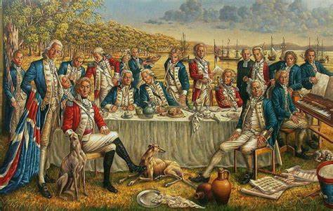
Captain Arthur Phillip assembled the “First Fleet” to carry the first load of convicts to New South Wales, no longer New Holland but now claimed as British Crown land. There were 11 ships carrying approximately 750 convicts and 550 sailors and soldiers. Over the next 80 years roughly 162,000 convicts were transported to settlements at Port Jackson (later Sydney), Moreton Bay (later Brisbane), Swan River (later Perth) with the most notorious and desperate convicts sent to the island of Van Diemen’s Land (later Tasmania). And despite the teaching of generations of Australian school children that many of these convicts had committed petty crimes like stealing a handkerchief, the reality according to historians like Robert Hughes in his wonderful book “The Fatal Shore” is that the majority were in fact hardened criminals. Only two of the early colonies, Port Phillip Bay (later Melbourne) and South Australia never officially received convicts though the proximity of Melbourne to Tasmania meant that several thousand convicts were used in government construction projects in the state of Victoria in the early and mid 1800s.
There is no question that the motivation and character of the earliest settlers of the American colonies have shaped the soul of today’s states they established. Massachusetts still reflects the liberal and self-denying zeal of the Pilgrims and Puritans, while Virginia continues to reflect the conservative and capitalist leanings of the early tobacco growers of Jamestown. Similarly Adelaide and Melbourne continue to glory in their freedom from the taint of a convict past, with Adelaide undoubtedly proudly and somewhat arrogantly waving their perceived superiority in the face of the major cities that have a convict heritage. In return the brash and ethically challenged Sydneysiders enjoy labelling Adelaide “The City of Churches” and Melbourne simple boring.
So if South Australia had no convicts, how and why did people go there? By the early 1800’s all of the convict colonies had been established leaving a gap on the south coast where Matthew Flinders had mapped the Gulfs of St Vincent and Spencer and had identified and named Kangaroo Island. Charles Sturt, a famous early inland explorer had followed the mighty Murray River from the west side of the Australian alps in Victoria and New South Wales to its mouth on the south coast not too far from Kangaroo Island. He suggested that the land looked promising for settlement. Back in London a group of entrepreneurs and investors led by George Fife Angas promoted a scheme devised by one Edward Gibbon Wakefield (no relation to the English historian Edward Gibbon who had written The History of the Decline and Fall of the Roman Empire a few years earlier in the late 1700’s).

Somewhat inconveniently for the Adelaideans who brag to Sydneysiders about their pure heritage, Wakefield was in prison at the time he wrote his theory of structured colonization that subsequently became the basis for George Angas’s “South Australian Company”. Wakefield’s crimes had been to abduct and elope with an underage fifteen year old young woman and following her death, to repeat the crime for which he was imprisoned for three years. Presumably he was successfully rehabilitated by his time in prison because he subsequently became a member of the British Parliament.
The structured colonization scheme of Wakefield was managed by the South Australian Company under the leadership of George Angas for many decades beginning in 1834. Even though the British Crown had not chosen to colonize the state of South Australia, they nevertheless insisted on a part interest in the project including appointing a governor as a representative of the King.
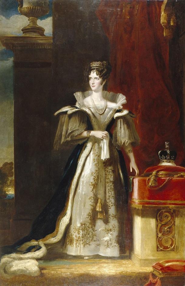
At the time the king was William the Fourth, the uncle of Queen Victoria who herself was to be the last in the line of the House of Hanover which had begun with George the First. And his wife was Adelaide and hence the names of the state’s capital city and its main boulevard, King William Street. Few South Australians are aware that Queen Adelaide’s official title at the time was Queen of Saxe-Meiningen, consort of the King of Hanover of Germany. But perhaps the German roots contributed to what later became a strong German heritage in South Australia including some of my own ancestors. But more about that later.
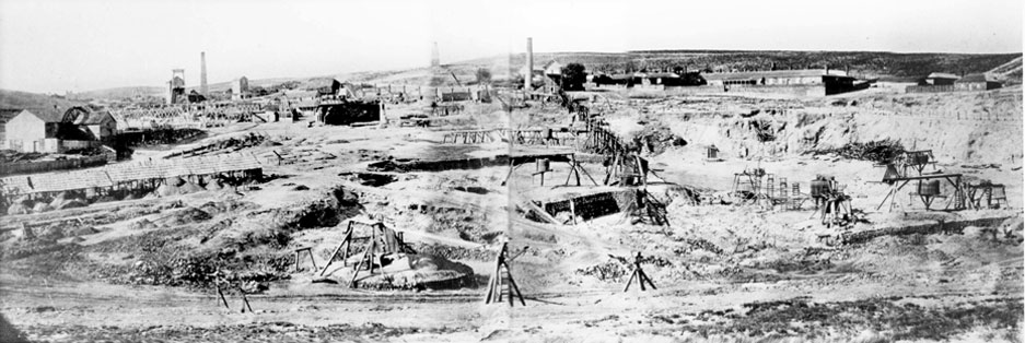
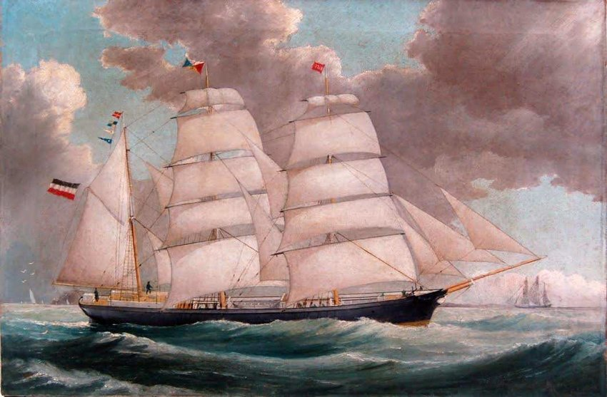
Wakefield’s plan involved paying for the passage of working men and women to the new colony using funds raised through the sale of large tracts of land to wealthy investors. Everything was planned including the layout of the new capital city as an exact square mile surrounded by parklands. The number of tradesmen and laborers in many different categories was specified. Young single women in particular were encouraged to migrate. Within a few years of the foundation of the new state, important mineral deposits were identified, particularly copper in a region about 100 miles north of Adelaide around the town of Burra close to the Clare Valley. Experienced miners were needed and soon began to migrate from Cornwall and Devon where tin mines had been in existence from the days of the Romans. And the port of Plymouth in Devon was a point of departure for many of the sailing ships that set off on the daunting 3 to 4 month voyage to South Australia.